SEARCH BY VEHICLE
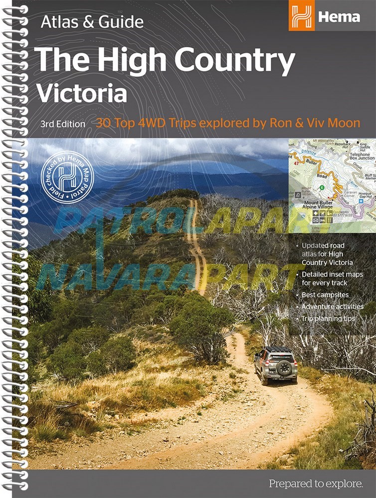

High Country, Victoria Atlas & Guide (Hema Maps)
NEW 3rd EDITION
Containing 30 Top 4WD Trips
Part 4WD guide, part travel companion, The High Country Atlas and Guide will help you make the most of your time in Victoria's stunning, mountainous High Country. It provides in-depth coverage of the High Country from Mansfield and Wangaratta in the west to Snowy River National Park in the east, and from the ski fields at Perisher Valley in the north to Lakes Entrance in the south. It offers loads of useful information on the area's rich history, activities and attractions to be enjoyed in all seasons. It also details the 30 most outstanding 4WD excursions the High Country has to offer including inset maps, track descriptions, tips, warnings and more to get you up and running. Along with town and supply centre information you can read about the many sights and activities available in Alpine National Park, Snowy River National Park and Baw Baw National Park. Whether you're looking for a serious four-wheel drive adventure, a winery tour, a walking trail or a place to stay, this book with its easy-to-follow maps throughout is an indispensible companion.
- Field Checked by Ron Moon.
- 40 Atlas Pages.
- Handy atlas for navigation - from Hema's best-selling High Country map
- Top 30 4WD Trips, including inset maps, track descriptions and information, warnings and sites worth exploring
- Detailed maps throughout, including southeast New South Wales
- When to go and how to prepare for the alpine conditions of the High Country
- Where to go for the best outdoor experiences - including bushwalking trails and camping spots.
- Where to stay, from Bandamp;Bs to the best bush-camping sites
- Extensive listings of tour operators - tag-along tours, renting equipment, guided hiking and horse riding, and much more
- Background reading on the region's geography, history, flora and fauna.
| ISBN: | 9781876413149 |
| Size: | 298mm X 215mm. |
| Pages: | 208 pages. |
| Binding: | Laminated board cover. Spiral bound. |
| Publication Date: | 3rd edition (2017). |
| Images (Colour or Mono) | Colour. |
| Author and/or publisher | Hema Maps Pty Ltd. |
Please check out our other maps and books for sale.